
Contact Seller

*Under Contract*West Barton County Farm and Hunt
Description
Property Location: 6 miles northwest of Pawnee Rock, Kansas.
Legal Description:
- S07, T20, R15W, S/2 LESS TR COM SECOR SW/4 TH W503, N300, E03, S300 POB &LESS R/W in Barton County
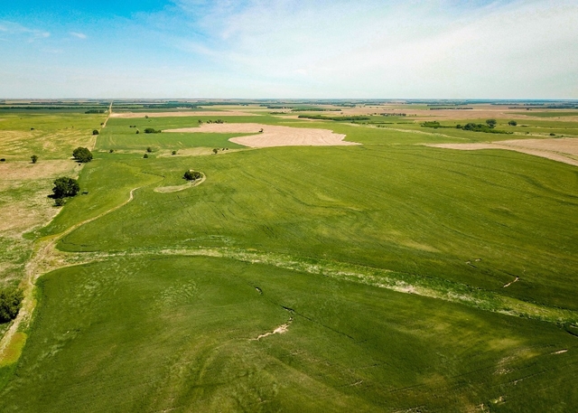
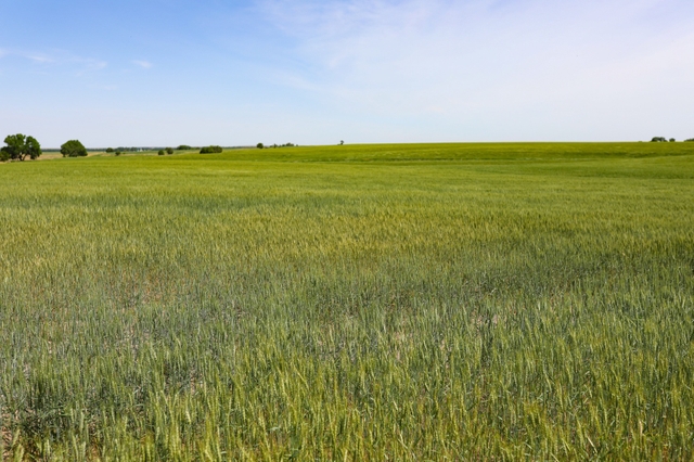
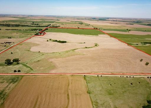
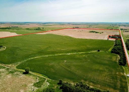
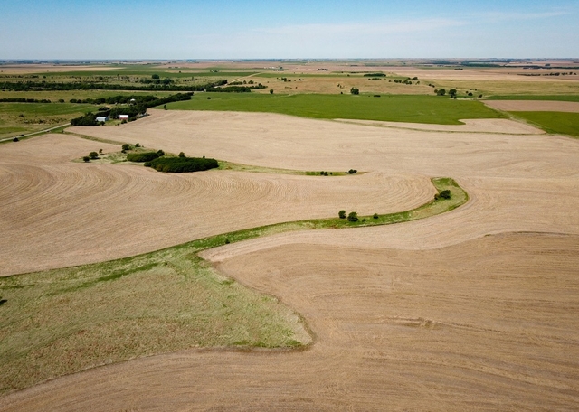
Land Description: Here is a beautiful and diverse property with quiet blacktop frontage that is sure to appeal to almost everyone. This property has a great combination of timber, beautiful waterways and quality cropland all along rolling hills. There are endless opportunities between farming, hunting and the potential to build. The rolling hills create the beautiful views overlooking the entire property that would make a perfect porch view from a new home. The mature shelterbelt on the south side of the property creates not only a wind break to the property but a natural habitat for wildlife. Various waterways with a mix of good timber and native grasses run through the middle of the property and encompass various clusters of trees. On the southeast corner of the property stands a cluster of trees adjacent to a tract of CRP. There are several driveways with culverts along the main road to the farm ground giving easy access for farm equipment. The waterways, CRP, and timber all surrounded by fertile cropland gives this property nearly every type of habitat needed to hold large whitetailed deer and phenomenal pheasant and quail habitat. This is a beautiful property with various opportunities for farming, hunting, and homesites.
State Hunt Unit: 5
Financials:
- 2021 Real Estate Taxes: $4,270.96
- Crop Share (, )
- CRP Payments: $34.99/acre and expires 9/30/2035
- Potential Hunting Lease: $2,000/year
______________________________________________________________
Yields:
Crops Base Acreage PLC Yield
Wheat 186.5 47
Grain Sorghum 71.78 63
Total Base Acres: 258.28
CRP Acres: 19.05
______________________________________________________________
Soils: Comprised mainly of Class 2 and 3 soils
- Uly silt loam, 3 to 6 percent slopes: 164.42 acres
- Harney silt loam, 1 to 3 percent slopes: 114.85 acres
- Roxbury silt loam, occasionally flooded: 27.06 acres
- Nibson-Wakeen silt loams, 3 to 20 percent slopes: 4.48 acres
**See attached FSA Maps**
Directions:
- From Pawnee Rock/US 56W, head north on SW 110 Ave/Township Rd toward Bismark Ave for 3.6 miles then turn left onto SW 30 Rd. Property is located to the north in 2 miles.
- From Great Bend, head west on US 56 W and in 3.7 miles turn right onto SW 30 Rd. Go straight for 7.8 miles and then the property is on the north side of the road.
Community/Attractions:
- 6 miles Northwest of Pawnee Rock (population: 312)
- 13 ½ miles West of Great Bend and Great Bend Municipal Airport (population: 14,733)
- 14 miles Northeast of Larned (population: 3,732)
- 20 miles Southwest of Cheyenne Bottoms Refuge, the largest wetland in the interior United States
- 20 miles Northeast of Fort Larned National Historic Site
- 54 miles Southeast of Hays (population: 20,855)
- 1 ½ hours Southwest of Salina (population: 46,706)
- 2 hours Northwest of Wichita and Dwight D. Eisenhower International Airport (population: 390,566)
For more detailed financial information or qualified showing, please contact J.C. Bosch. Co-Brokers welcome.